Overview
The goal here is to rasterize the contents of a netCDF file containing global sea ice concentrations in October from 1981 to 2020, and then compile each of those rasters into a single gif.
Libraries
import xarray as xr
import rasterio as rio
import pandas as pd
from rasterio.plot import show
import matplotlib.pyplot as plt
import rioxarray
import imageio
Dataset
These data are a small subset I created of the Merged Hadley-OI sea surface temperature and sea ice concentration dataset. We’ll read them in as an xarray dataset.
ice = xr.open_dataset("data/noaa_ice_81-20.nc")Becuase we’re working with spatial data, we need to set the coordinate reference system (CRS) and specify our spatial dimensions—in this case: lon and lat.
ice = ice.rio.write_crs(4326, inplace=True)

ice = ice['SEAICE'].rio.set_spatial_dims('lon', 'lat')

ice = ice.rename({'lat':'latitude', 'lon':'longitude'})
Creating the rasters
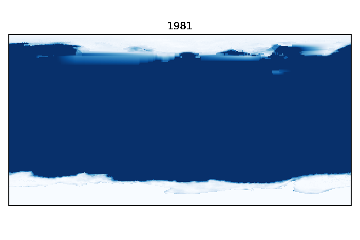
Here we create a loop that exports the sea ice data from each year as a tiff using rasterio.to_raster(), renders it (quietly) with pyplot.imshow(), and then saves the formatted image as a png with pyplot.savefig(). An important part of the formatting portion of the loop is titling each image with its corresponding year: plt.title(years[i]).
years = range(1981, 2021)

rasters = []
for i in range(0, len(ice)):
ice_i = ice[i]
tiff = 'Data/noaa_ice_' + str(years[i]) + '.tif'
ice_i.rio.to_raster(tiff)
# opening the tiff we just exported
open_rast = rio.open(tiff)
# reading the first (and only) band within the raster
read_rast = open_rast.read(1)
# preventing matplotlib from displaying every image
plt.ioff()
plt.figure(frameon=False)
plt.imshow(read_rast,
origin='lower',
cmap='Blues_r',
extent=[-180, 180, -90, 90])
plt.title(years[i])
plt.tick_params(left=False, bottom=False)
plt.xticks([])
plt.yticks([])
plt.tight_layout()
png = tiff + ".png"
# save the figure we just created with a resolution of 200 dpi
plt.savefig(png, dpi=200)
plt.close()
# compiling a list of the file names for the next step
rasters.append(png)Creating the gif
Lastly we’ll use the imageio library to create the final animation. To do this, we iterate through the list of png files we created in the last loop, reading each of them in using imageio.imread() and compiling them into a new list. We then feed that list into imageio.mimsave() which aggregates and exports the images as a gif. The default frame rate is quite fast, so we can increase the duration to 0.5 seconds to make the animation a bit more digestible.
png_imageio = []

for file in rasters:
    png_imageio.append(imageio.imread(file))

imageio.mimsave('Data/ice_81_20.gif', png_imageio, **{'duration':0.5})
The final product